Ghost Highway Project
The ‘Ghost Highway’ refers to Rodeo Highway, which ran historically from the ocean and cattle ranch side of the southern Marin peninsula all the way across to the shores of the port town of Sausalito. When the 101 Freeway connected San Francisco to her northern sister city San Rafael in Marin, it cut a line through the land and severed Rodeo in half, making it impossible for any wildlife to cross without risking certain death. Rodeo Highway is now a Ghost Highway.
Project includes video installations, digital maps, sculptural topographic maps, workshops and advocacy work to raise awareness of how roads impact the movement of wildlife. Collateral from the project has been used to make real change in the region, where Jennifer has helped local conservation organizations protect wildlife refuge lands and build a movement to increase access points for wildlife crossings in southern Marin.
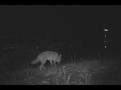
Urban spaces transform under the cover of darkness, from places people know as their own to those where their wild neighbors hunt, play and live their unseen lives. Here on the eastern, residential side of the Ghost Highway, nightly visits of animals adapted to urban environments such as coyotes and foxes can be seen.
Rodeo Avenue once stretched from shore to shore and was a major road for humans travelling the Sausalito peninsula. It was severed by the 101 freeway, and is now a Ghost Highway. Here on the West side one can encounter the animals of wilderness areas: such as bobcats, badgers, and puma, as well as the more adapted species such as coyotes, foxes and deer.

The theme of this show was to bring that which is hidden about the Bay Area to public attention. I was invited to explore the topic of urban wildlife as community, and so created three topographic sculptures of urban animals plus a series of videos showing vista spots where people flocked by day and animals roamed by night. This was the beginning of the Ghost Highway Project.

This 3 dimensional topographic map shows the home territory and hard boundary of this young male coyote who chose to make his home here until a car on the 280 freeway killed him. This series raises awareness of the need for wildlife corridors, even in cities like San Francisco.
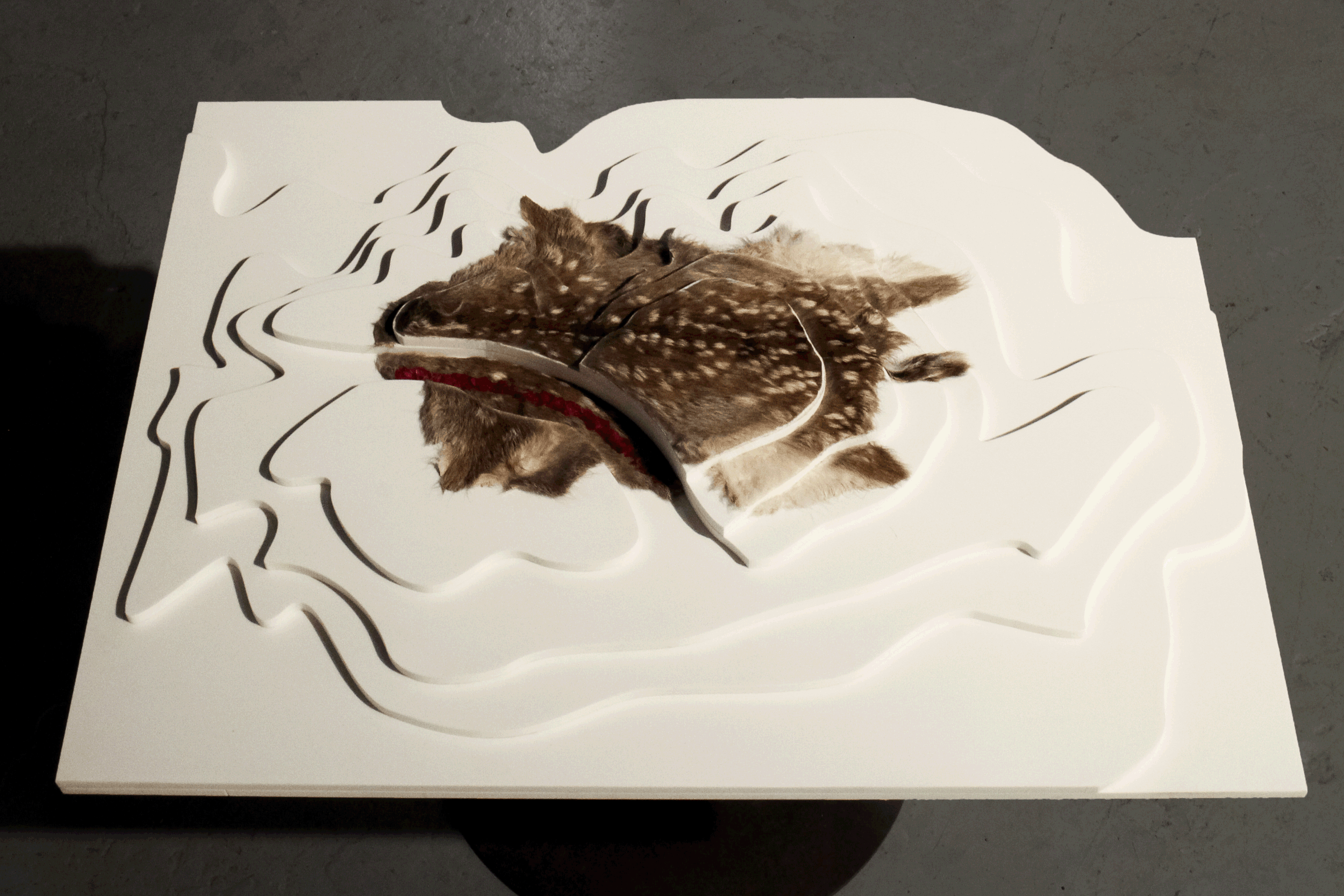
This fawn creates its own 3 dimensional topographic map, showing her home range had she grown to be an adult. This fawn was only hours old when the 101 freeway through Sausalito's open space killed her. This project intends to increase awareness of the need for wildlife corridors on the 101 freeway, and since this project, Caltrans has agreed to take measures to improve conditions for wildlife and help prevent their needless death on the Ghost Highway.

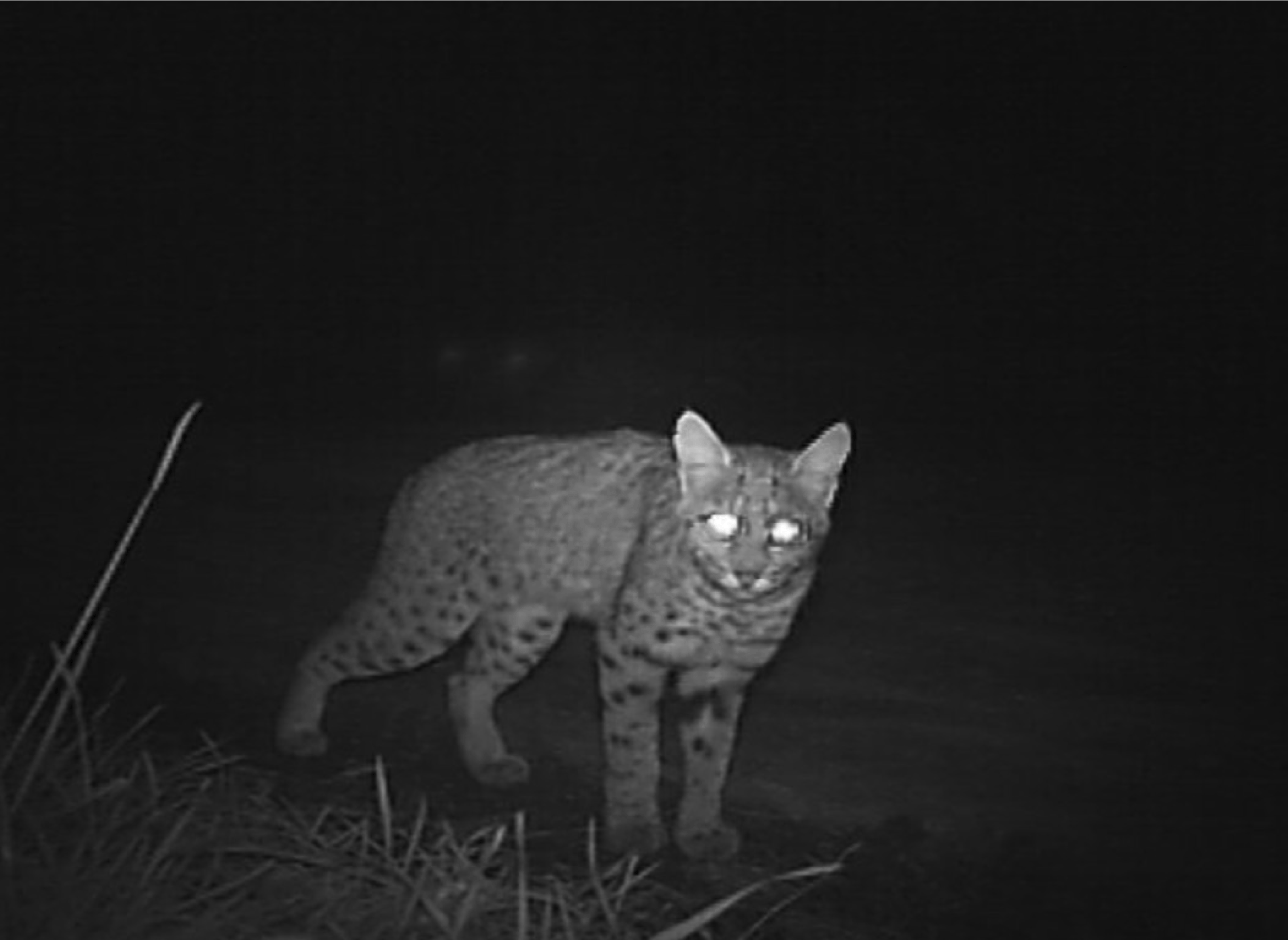
There are a surprising number of species on the east side of 101, especially since it’s just a narrow band of open space between the freeway and dense residential neighborhoods. Over the years, I’ve documented aquatic amphibians, foxes, coyotes, and even a few badgers and bobcats here. For years, I’ve wondered how this land could support so many animals.
That is, until a non-profit group called Open Space Sausalito (OSS) approached me to help them raise funds for a parcel they were trying to purchase to put into conservation. I conducted a field survey to write a report for the land, and it was then that I put all of the pieces together. On this little parcel there is a creek where water flows from a spring above the freeway, and the animals travel long distances to my neighborhood for water every night. It is essential to their survival. This creek was unnamed, so we decided to call it ‘Saucelito Creek’, the original spelling for our town, which means ‘little willow’ in Portuguese and signified a rich source of year-round water.
In addition to the report, I shared my Ghost Highway Project work with the public and hosted local lectures on the site, and with this OSS was able to raise the funds to purchase the land and turn it into a wildlife refuge. I now sit on the board as their ‘Biologist in Residence’, working with other local non-profits and government agencies on a city-wide effort to daylight our creeks, restore habitat, and raise awareness for wildlife. OSS is also working with GGNRA and rangers from the National Parks Service in negotiation with Caltrans to widen the culvert under the freeway through which Saucelito creek runs, to allow wildlife to walk up the creek and allow safe passage under the freeway.
In this photo, OSS President Bill Monnet is describing a discovery to former City Council and OSS Board member Leon Hunting.
photo by Amy Osborne, Special To The Chronicle

For this map I document the necklace of small parcels that together make up 50 acres of land used by local wildlife. Methods for documentation include field collection with infrared camera traps, tracking, research of historic maps, interviews of residents, and primary research. This map was created for Open Space Sausalito, a non-profit who, with the help of my work, were able to save the last undeveloped spring and natural creek in Northern Sausalito.
Marin Independent Journal Article on OSS
Marin Independent Journal Editorial citizen-supported Conservation
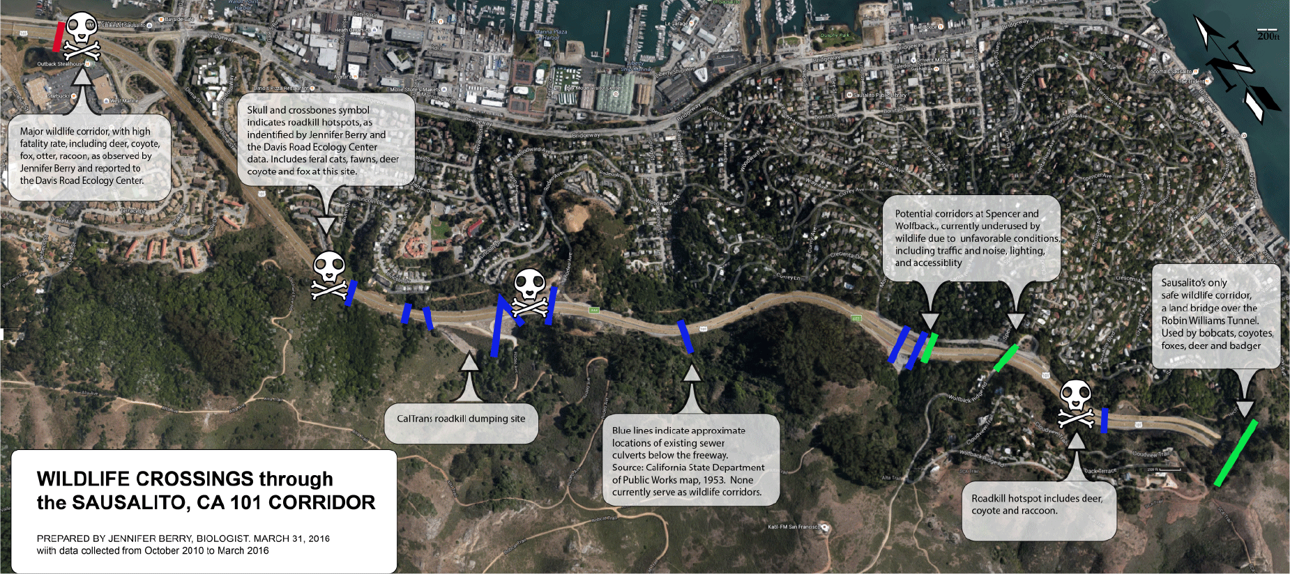
This map documents places where wildlife attempted and failed to cross the 101 freeway in Sausalito during my research and indicates existing culverts that could be improved to allow animals to cross under the freeway. What began as teaching tool for my Ecology class at Berkeley to illustrate the ways in which traffic engineering often destroys communities, this map has been used by advocates when approaching CALTRANS, the California transit authority, to improve this stretch of the freeway, which was labelled as one in ten hotspots in California for roadkill by the UC Davis Road Ecology Center in 2014.
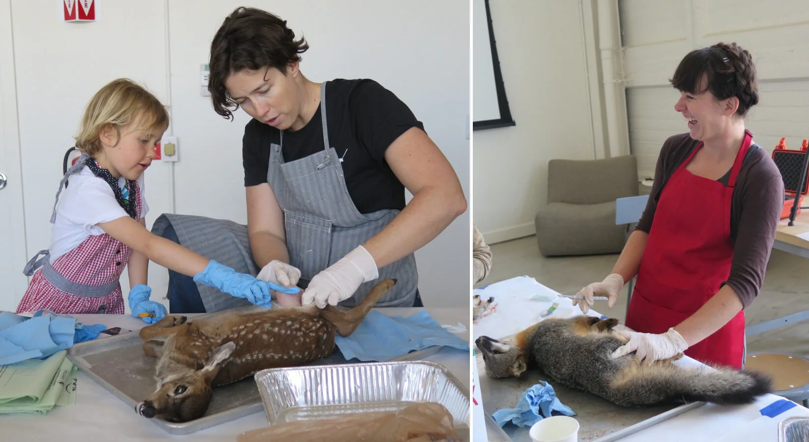
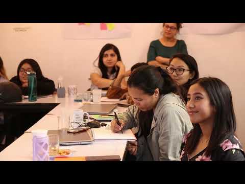
While in residence at Autodesk's Pier 9 Workshop, I invited artists and scientists from my community over for a skinning workshop. Our goal was to prepare these beautiful animal skins for use as raw material for art and science projects. The caveat was that you had to choose from my storage freezer one of the specimen I had gathered while doing roadkill surveys. As you can see, we had a lot of fun.